A father of two sons and grandfather of two girls Cameron McNeish has always been on the lookout for good family walks. Here he recommends five great family outings. ONE of the great joys of the Cairngorms National Park is that there is something for everyone, from long mountaineering expeditions to summer low level strolls. As such it’s an ideal destination for families, with something of interest around every corner.
With spring beginning to take hold here are five recommended family outings, walks that I have enjoyed with my own family without suffering the dreaded ‘are we nearly there’ pleas!
1. Creag a’ Chlamhain
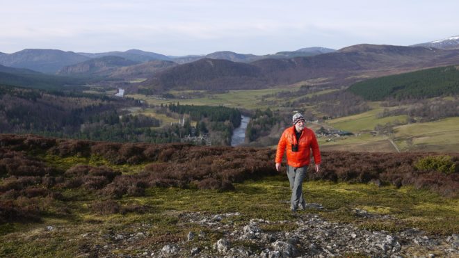
Creag a’ Chlamhain is a wonderful little hill situated above Crathie on Royal Deeside. It’s 465m in height but the two-mile track to the summit is fairly winding and never becomes too steep.
Not far from the start the track passes some buildings. This is the former home of Rob Bain, a well-known local character whose mother Jean Bain was the last native speaker of Deeside Gaelic. She died in 1984. Rob died in July 2010, one of the last ‘crofters’ on Deeside.
Beyond the buildings the landscape changes and becomes more open and you’ll be surprised to find yourself walking through the remains of an old village. Who lived here? What moved the people to abandon their homes? It’s a wonderful position for a small township with views up Glen Gairn and across to the great swell of Culardoch.

The track climbs through a wood of pine, birch and juniper to the bare heather slopes of the double-topped summit. The first top has a communications mast dominating it but wander beyond that, your gaze taken by a fine view of Lochnagar in front of you, to the second summit with its big cairn and look west along the narrowing strath of the Dee, past the spires of royal Balmoral Castle to the big hills around Braemar, Carn a’ Drochaide and Morrone.
The combination of pinewood and river, green fields and big rounded hills makes upper Deeside so spectacular and from this high point you can witness it all.
2. Conachcraig
Conachcraig is the eastern neighbour of dark Lochnagar. Its ascent shares the same route to Lochnagar from Allt-na-giubhsaich as far as the high point of the track that runs between the Spittal of Glenmuick and Glen Gelder. At this point the Lochnagar track, and the crowds, veer away to the west to climb up to the bealach below Meikle Pap. The route to Conachcraig goes in the opposite direction and follows a less-used path that wriggles its way up the heather and boulder slopes towards the hill’s summit.
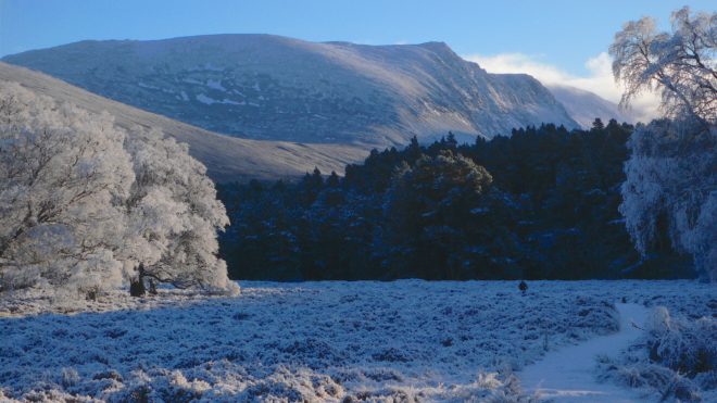
It’s well worthwhile crossing the broad ridge to Conachcraig’s slightly lower north summit, if only for the much better view it offers towards neighbouring Lochnagar. From the main summit you’re at too tight an angle to see much of Lochnagar, other than it’s rather dull Meikle Pap slopes, but from Conachcraig’s 850m top you get a much better view of the mountain. From here you get a glimpse into the great, dark corrie that is such a feature of Lochnagar and whose cliffs make it one of the principal winter climbing venues in Scotland.

3. Rothiemurchus and the Lairig Ghru
The great trough of the Lairig Ghru, the gloomy pass, cuts through the bulky massif of the Cairngorms, a great cleft caused by glaciation with the swelling upthrusts of Beinn Macdui on one side and Braeriach on the other – Britain’s second and third highest hills respectively. Take a wander through the ancient forest of Rothiemurchus to a high point from where you can virtually gaze into the jaws of the Lairig itself.
Rothiemurchus is the name of the parish that lies between the River Spey and the summits of the high Cairngorms. Because of the rich variety of the landforms contained in the estate the landscape passes from low lying agricultural fields, through open heather moorland to the magnificent remnants of the ancient Forest of Caledonia. The early history of the area was varied and colourful and its ownership passed through the hands of the Comyns, Gordons, Shaws and Macintosh’s before settling in those of Patrick Grant of Muckerach, the second son of the Chief of Clan Grant in 1580.

The route of the Lairig Ghru was used in times gone by as a drove road, one of the highest in the country, and today is one of the classic high level passes in Scotland. Leave Coylumbridge on the Glenmore road and follow the path to the old Cairngorm Club footbridge over the Allt Druie. The path now crosses a large clearing in the old pine woods with the V-shape of the Lairig away ahead. The path continues beyond the river to a path junction known locally as Picadilly!
From here the route is upwards, climbing steadily past ancient pines, gnarled with time, trees which gradually become smaller and more stunted the higher you climb. Soon you’ll leave the pines behind you and you’ll reach another path leading off to the left. This is the high point of the route and from here you can enjoy the views into the jaws of the Lairig Ghru and behind you over Rothiemurchus towards the blue swell of the Monadh Liath hills.
4. Tomintoul
There is a lovely, and easy, walk around Tomintoul, that is ideal for a spring afternoon. The historic village is said to be the highest village in the highlands, although it’s not strictly in Highland Region. I suspect Dalwhinnie on the A9 would correctly make the claim of being the highest village in the Highlands.
However, there is a definite feel on being ‘on the edge’ in Tomintoul. Winters can be horrendously hard and the road between the village, over the Lecht to Corgarff, is often the first road blocked by snow. Tomintoul was built on a grid of three main streets by the Duke of Gordon in 1775, and it was an important stopping-off and overnight staging post on General Caulfeild’s military road.
This walk follows a series of new and older paths around the village, the highlight being the tempting views up the length of the River Avon to the distanct Cairngorms. The route is about 3 miles in length.

Leave the car park and cross the main road to a corner. Follow the road signposted to Glenlivet for a short distance to a picnic area on your left. Go through the picnic area to a gate that gives access to a footpath through open country. Go through two sets of gates before the path bends to the right as it approached the Conglass Water. The path then turns left and crosses a footbridge before entering some woodland. Climb a short verge to meet the Speyside Way, which is followed for a short distance to another picnic area by the main road. At this point turn immediately right and follow the private road that climbs steadily above the main road. Just after a memorial plaque take a path downhill to the left to cross the main road. Descend a flight of wooden steps to two gates. After going through the second gate turn left and follow the path through woodland. Stay on this path until you meet a gate. Go through the gate to a path with a fence on either side. At the end of the fence turn right and follow the path to a road which takes you back into Tomintoul and some well deserved coffee and cake.
5. The Pictish fort of Dun-da-lamh
Sitting atop a conical hill that dominates upper Badenoch the Pictish fort of Dun-da-lamh is well worth a visit, if only to understand that the strategic positioning of such forts were, as much as anything else, clear statements of tribal ownership.
Dun da Lamh overlooks the junction of Glen Shira and the River Spey to the north and Strath Mashie and River Mashie to the south, hence its name – the fort of the two hands.
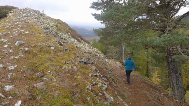
It’s an impressive place. The interior of the fort covers an area of some 4000 square metres and what’s left of the ramparts are built from small slabs. Given the rampart are up to 7.5 metres in width this fort must have originally been an impressive fortification.

It’s thought Dun-da-lamh dates from the Iron Age, the later half of the first millennium BC.
Leave the Wolftrax car park near Laggan and carefully cross the often busy A86. Just beyond the little forestry hamlet of Achduchil a wide track runs off to the left of the main road. After a kilometre or so, at a wide layby, turn left onto a narrower forest track that rises gently above the fields of Strath Mashie.
This track runs all the way westwards to the A86 at Feagour, but if you want to visit the hill fort, which involves a relatively steep climb on foot, turn right at the next junction. Follow this path to an obvious turning point where a signposts points out a narrow footpath climbing through the trees to the left. This leads to a picnic bench and more signs. Turn right here and climb steeply to the remains of the fort.
The remains cover a surprisingly large area and the views are extensive. Look north, over the young River Spey, towards the Munro of Geal Charn and the rise of the Monadh Liath and Corrieyairack hills; east along the widening strath of the River Spey towards the Cairngorms, and south into the Strath Mashie and the pine-covered hills of the Wolftrax mountain biking centre.
For more ideas on walks in the Cairngorms please see our other blogs.
Join our Mailing List
Sign up to get notified of the latest deals, news and all the latest information direct to your inbox.
