
The historic region of Badenoch is a wonderful place to explore on foot. You can really get a sense of the history as you walk the land, with lots of sights remaining as signs of a fascinating past. Download the Badenoch the Storylands app where you can follow these walks with a map and find out about the stories of Badenoch past.
Always carry a paper map for navigtion as a backup and don’t rely on a mobile device.
Always follow the Scottish Outdoor Access Code as you go as some of the walks cross farmland, areas of ground nesting birds and sometimes forestry operations.
Feshiebridge to Inshriach: 8 miles | approx 3 hours
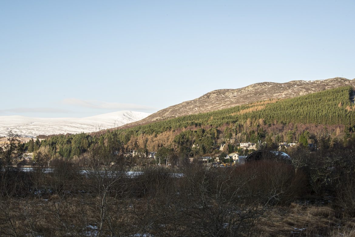
This walk is on mixed surfaces largely following estate tracks through the forest, and takes about 3 hours. The tour starts at the Frank Bruce Sculpture Trail car park and goes down towards the mouth of the River Feshie and An Sithean. It then turns up to Dalnavert and passes a memorial to the forebears of the first Prime Minister of Canada and goes on to Inshriach with views across to Tor Alvie and the Duke of Gordon Monument. It then returns to Feshiebridge through the forest. Visitors can choose if they wish to extend the walk by going to see Feshie Bridge and the Frank Bruce Sculpture Park just over the river towards Kincraig.


Crubenbeg to the Centre of Scotland: 5 miles | approx 2 hours
This starts from the car park just off the A9 (at the Crubenmore turning), to the Centre of Scotland Stone and Cluny Macpherson Cairn. Crubenbeg House and Grave and Cluny Castle and Cave are not accessible but when you stop at the Ewen Macpherson of Cluny Cairn they are visible.
Most of the track is rough, damp and quite undulating in places with a total ascent of just under 700 feet, so will take a couple of hours at least. The tour crosses the bridge by the spectacular Tromie Falls and takes a path off through the woods. It eventually follows an indistinct right of way to join in with the Wade Road, crossing fields that will have livestock in them at certain times of year and also an area with ground nesting birds, so walkers should follow the Scottish Outdoor Access Code.
The view up the Spey Valley from the Cairn is stunning and overlooks Cluny Castle and Creag Dubh. Walkers can either retrace their steps, taking in the nearby viewpoint, or continue clockwise until the road joins the A9 when you can follow the cycle track back to the car park.


Glen Banchor and the lost townships: 5 miles | approx 2 hours
The starting point for this 5 mile walk is the car park by Shepherd’s Bridge on Glen Road in Newtonmore. Care is needed on this road in wintertime as it is not always cleared or gritted. While the main part of the route is on estate tracks, the remainder is on open ground which can become boggy, so stout footwear is the order of the day. It also passes through areas where there can be ground nesting birds, livestock and forestry operations so walkers are reminded to follow the Scottish Outdoor Access Code.
As you go up the Glen, there are a number of ruined settlements, some more easily accessed and visible than others. On the way back you can see the hillock near the Shepherd’s Bridge known as Sidhean Mor Dail a’Chaorainn (“the big fairy hill of the meadow of the rowan tree” or Johnny Blair’s Garden) which was the site of a palisaded enclosure before a local man demonstrated it was possible to grow flowers and vegetables on top of the hill.
Easterton and Westerton are two of the townships and in the early 1800s, there were twelve tenant farmers working runrig here, its maximum population numbering between 60-100 people just in this one small part of the glen. After the clearances in 1876, by 1891 the only occupants working in the entire glen were two shepherds.


Torr Alvie Hill and the Duke of Gordon Monument: 5 miles | approx 3 hours
This walk of almost 5 miles takes you from the car park at Dalraddy up to the top of Torr Alvie, where the Duke of Gordon Monument stands. The route involves an ascent of about 600 feet so takes around 3 hours once you take in the view from the top, where there are signs of an ancient hill fort. Looking down over Loch Alvie, there is a growing belief that this gap between the hills was the site of the Battle of Nechtansmere in 685AD.
The large field at Croftgowan has been revealed during recent very dry summers to be the site of the largest Scottish barrow cemetery discovered to date, and further archaeological investigations are planned. On the way to the top, close by the route (to the east) is the Waterloo Cairn, an unusual structure dating from the early 1830s. The return route takes you gently down and then follows the estate road, from where you can take a spur to see the Duchess of Gordon’s Monument.


Kingussie, Loch Gynack and Ballachroan: 6 miles | approx 2.5 hours
This circular tour starts from the Ardvonie car park (with toilet facilities) and folows a mixture of roads and some paths over rough ground. Stout footwear is advisable for this walk which will take around 2 and a half hours. After going up the top of the golf course where there is the abandoned township of Toman an t’Seomair and into the forest, there is a potential detour to the top of Creag Beag overlooking the village (taking about an hour). The route goes through birch forest and then over open moorland and takes you past the abandoned house of ‘the Black Officer’, before joining the cycle and footpath back to Kingussie.
The Black Officer took up tenancy at Ballachraon and, like his neighbour, he set about improving the standard of husbandry. This he did by adding lime to the peaty soil and spreading sand to make the ground more workable; and the outcome was an abundant crop. He also introduced crop rotation and introduced turnips, which were not then widely known. Perhaps it was his outstanding crops which gave rise to the suggestion that he had entered into an arrangement with the Devil. The was indeed the story that he had an arrangement with the Devil whereby the Devil would take the roots of whatever the Captain planted. In the first year, the Captain only sowed barley. He harvested his crop; and when the Devil came for his share, the Captain told the Devil that he could take the roots, as agreed in their contract. The Devil was angry at being so cheated and insisted the following year he would take the crop and leave the Captain with the roots. Unsurprisingly, the Captain then planted potatoes and turnips, and when the Devil discovered that he was again to get nothing, he departed in a rage – only returning to seal the fate of the Captain in Gaick where after a terrific snowstorm set in in 1800 and he and others were killed in an avalanche. You can see a commemorative cairn close to Gaick Lodge which was erected in 1902.

Kingussie to Raitts Township and Souterrain: 6 miles | approx 2 hours
This 6 mile walk takes you on some roads and country tracks starting from Ardvonie car park in Kingussie. The track is undulating climbing almost 600 feet in total, and sturdy footwear is recommended, as it can be damp underfoot and there are a couple of streams to cross. Walk up to the golf course and from there cross the bridge over the Gynack Burn and walk up the road to the forest track marked Tom Baraidh. Following the perimeter track, turn off to left and followthe tracks over the moorland. Look out for the blue arrows to Raitts beside the track after about 500 yards. Once you go into the gated land, be aware there may be animals grazing, so walkers are requested to heed the Scottish Outdoor Access Code.
it will take a couple of hours depending on how long you spend investigating Raitts Soutterain, Raitts Township and the corn kilns (signposted when you get there). When you return you can come down Dunbarry Road and go along East Terrace, passing the Clock Tower. At the junction, cross the road to seee St Columba’s Churchyard below you.
The Easter Raitts Township was extensively excavated between 1996-2000 with some of the finding dating back to the Neolithic age (the era when the farming of plants and animals begins, and when, as a result, humans first begin to create permanent settlements).


Kingussie to Loch Insh Viewing Point: 5 miles | approx 2 hours
This 5 mile walk is on good surfaces and largely follows part of the Speyside Way; it is therefore suitable for people with disabilities to enjoy the local sights. The walk should take a couple of hours, depending on how much time you spend investigating the two main locations of Ruthven Barracks and Insh Marshes bird hides. On the way back, you can investigate some of Kingussie’s other historic sites (including perhaps seeing a shinty match as you pass the Dell). Shinty has been played at the Dell for many years and is widely recognised as one of the best playing surfaces in the game.


Black Wood and Dun Da-Lamh Fort: 4 miles | approx 1.5 hours
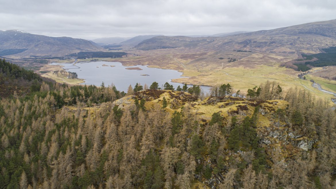
The tour starts from Laggan Wolftrax where there is a cafe and bike trails. The route is largely on forest tracks but the final section is rougher. The 4 mile route climbs about 650 feet and is steeper nearer the summit of Dun Da Lamh, where caution is needed, particularly in icy conditions. The summit rewards you with views over the Spey Dam towards the Corrieyairack Pass, and down the Spey Valley towards Laggan and beyond, showing the prominent position the hill fort held. The return route can be varied slightly as there are a number of forest tracks that lead back to Wolftrax. An alternative route for a longer walk back is possible by turning right at the picnic table as you descend and following the track that takes you over the adjoining ridge from where there are more open views.

You may also be interested in...

Itineraries
Beautiful Badenoch: Insider tips on one of the best short stays in Scotland
Local Story
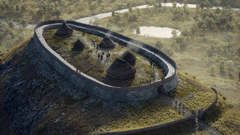
Ancient Sites of Badenoch Reconstructed

Visitor Attractions
Cairngorms culture trip: museums, distilleries and Scotland’s national game

Accommodation
Highland Hospitality – Top accommodation in Badenoch
Join our Mailing List
Sign up to get notified of the latest deals, news and all the latest information direct to your inbox.