
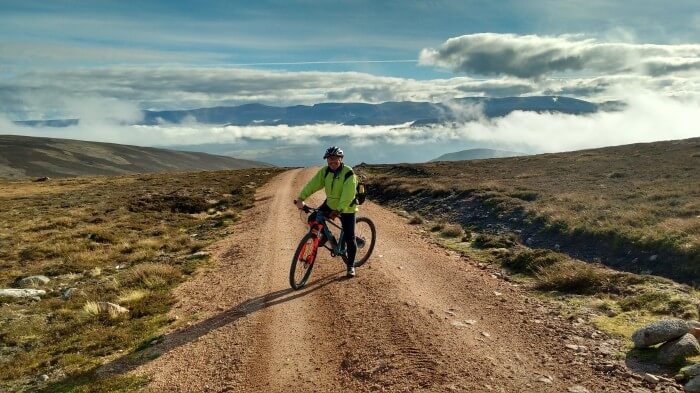
With so many choices of mountain biking routes and trails in the Cairngorms National Park, where will you head first? At mountain biking pace you can easily explore many miles of the National Park in just a few hours – or many, many more miles over the course of several days.
Getting off the beaten track on a mountain bike also reveals a wealth of up-close experiences, especially if you like to be surrounded by beautiful landscapes and have the opportunity to spot wildlife.
Brilliantly, the park boasts a huge range of mountain biking trails to suit all ages and fitness levels. From leisurely outings on wide trails that are easily accessible from villages and towns, to epic and challenging routes that take you into a fabulously wild and rugged terrain, you’ll discover more than you ever imagined on two wheels.
5 of the best MTB routes
1) Loch an Eilein Loop
Start/finish: Loch an Eilein car park, Rothiemurchus, near Aviemore

Distance: 5 miles.
Grade: Easy to moderate
There are a host of trails located on the Rothiemurchus Estate and many take you through fabulous woodland, including areas of ancient Caledonian Pine. This short loop of picturesque Loch an Eilein will give you are taste for what’s available in this area.
Loch an Eilein is a stunning area of water and usually boasts fabulous reflections of the surrounding trees. A ruined castle sits on a small island in the loch.
The terrain is mainly easy paths although there are a few rocky sections and tree roots, which can be slippery and muddy in wet weather. However, for most, it’s an easy ride.
For details and more ideas check out trails maps from Mikes Bikes, Bothy Bikes, Rothiemurchus or simply ask the helpful sales assistants.
2) Bike Glenlivet Trails Centre
Start/finish: Car park at the trail centre, near Tomintoul
Distance/grade: Easier Blue route is 9km (5.5 miles)
More challenging Red route is 22km (14 miles)

BikeGlenlivet on the Glenlivet Estate is located between the Ladder and Cromdale hills and offers a huge variety of landscape, including glens, rivers and mixed woodlands, as well as a wonderful sense of tranquillity.
The trails centre has two main routes. The blue is a good introduction to cross-country riding while the red offers more challenges and is almost three times as long.
See more details in the trails guide. Also Glenlivet Estate.
Other trail centres in Cairngorms National Park include Laggan Wolftrax and The Lecht.
3) Speyside Way
Start: Grantown-on-Spey
Finish: Boat of Garten
Distance: 11 miles
Grade: Easy (but you need to be able to ride 11 miles)

The Speyside Way links the sea at Buckie in Moray with the Cairngorms at Aviemore and at Tomintoul. The main path extends to 65 miles in the main and follows the course of the River Spey. There are also two spurs off the main path, one that heads an extra 15 miles to Tomintoul and the other of four miles to Dufftown.
There are plenty of options for mountain biking on the way including an 11-mile section from Grantown-on-Spey to Boat of Garten.
The route follows an old railway line to Nethy Bridge. You’ll then ride through nature reserve woodland and on to Boat of Garten. Take a detour to visit the Osprey Centre at RSPB Loch Garten.
Return the same way for a longer ride or arrange for transport to pick you up.
See Speyside Way
4) Mt Keen
Start/finish: Invermark car park, Glen Esk
Distance: 11 miles
Height gain: Around 700m
Grade: Moderate to difficult

Mt (Mount) Keen, with a summit of 939m, is the most easterly of Scotland’s 282 Munros. (The Scottish mountains classified as Munros are those with a peak of more than 3,000ft/914m).
Mt Keen is located to the south-east of the national park and at the end of the long and winding road through beautiful Glen Esk.
For a longer and more tiring day out you could choose to cycle through Glen Esk. If you prefer to ride only Mt Keen you’ll need to travel by car to start the bike ride at Invermark car park.
The route is on a mix of wide trails and narrower paths. It heads steadily uphill at first, through Glen Mark, before climbing more steeply and on rugged paths up the southern flank of the mountain.
In parts the route is technically challenging although this is mainly because of the steepness and loose rocks and stones. For most good mountain bikers the ascent will not pose too many issues but you will need to be fit to keep pedalling for the full 5.5 miles of uphill.
As you come out on to the wide, open moorland higher up, the terrain flattens and the path is more singletrack in style. The views over the wider Cairngorms park on a fine day will take your breath away and the chances are you will want to stop many times to take photographs.
The final push to the summit is over large boulders and unless you are very skilled you will probably walk your bike to the trig.
The ride back down is truly exhilarating and will take only about a quarter of the time that it took to ascend.
More details: Follow the same route as walkers for Mt Keen.
5) The Burma Road
Start/finish: Car park at Inverdruie, on the road to the ski centre, near Aviemore.
Distance: 26 miles
Grade: Challenging
Map: OS Landranger 35
This is classic must-ride route for experienced mountain bikers. It’s not super technical but it does feature a long climb and a total height gain of about 780m. The terrain is a mix of tarmac, wide tracks, singletrack and some boggy areas.
The route follows a two-mile tarmac section on the A9 before crossing the main road to go on to a minor road to Alltnacriche. Just before a Scripture Union Centre, the route turns right and heads through a forest gate. This is where the gradient steepens. A lot!
You’ll need to engage your easiest gear for the next three miles or so as the route climbs – and climbs. There are some slightly less challenging stretches but on the whole this is a leg-punishing climb on an off-road trail.
If you need a rest, get off your bike and look back at the views behind you. You’ll be wowed! Eventually, you’ll reach the top and the summit cairn where the reward is even more spectacular vistas.
You could return the way you came but this suggested route follows a fantastic track that descends speedily to a bridge over the River Dulnain. Another track takes you downstream to a bothy and through a field with Scots pines to go through a gate.
Head uphill on the track and at a junction follow signs to a road. There’s a new bridge at the tarmac road. Head right and then on to the B road back to Carrbridge.
You should look for signposts for NCN Route 7 that leads you via Boat of Garten on to the Speyside Way and returns you to Inverdruie .
The route is described on-line in various places, such as MapMyRide, or for an alternative start/finish at Aviemore and follow the description on P70 of the Highland e-guide by Developing Mountain Biking in Scotland.
Join our Mailing List
Sign up to get notified of the latest deals, news and all the latest information direct to your inbox.